NASA’s Fire Information for Resource Management System (FIRMS) allows for a novel technique in identifying strike locations. Though limitations exist in its application related to accuracy, it serves as an excellent supplementation alongside other OSINT techniques. We demonstrate its use in identifying an Israeli strike on an Iranian air defense (AD) site near Eslamshahr.
Background
FIRMS releases near real-time (within 3 hours barring the United States and Canada) fire data through sensors aboard the Aqua and Terra satellites, the Visible Infrared Imaging Radiometer Suite (VIIRS) aboard S-NPP, NOAA 20 and NOAA 21 (formally known as JPSS-1 and JPSS-2).
During Israel’s strike against Iran on the evening of October 25th, many central production facilities and air defense units were targeted. However, independent verification of these strikes were made difficult due to cloud cover and collection holds over traditional electro-optical satellites. Using FIRMS data allows for a new collection methodology that allowed us to independently verify a strike location that was previously unknown.
Methodology & Use Case
FIRMS alerted of a potential fire at a S-300 system stationed north of Eslamshahr (35.59694, 51.2365) at 23:01 on the 25th of October. This alert coincided with the Israeli retaliation strike against Iran. The first wave of attacks mainly targeted Iran’s AD systems in an effort to preempt any interceptions.
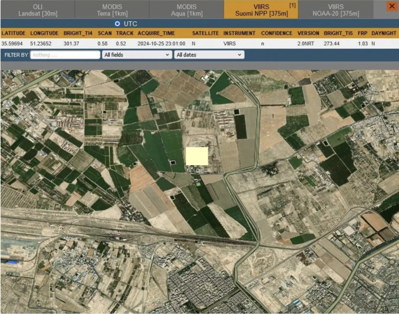
While the FIRMS alert serves as an initial “tip-off”, this is not enough to verify claims of a strike. FIRMS issued 12 alerts across Tehran on the 25th alone, most of which point towards refineries and other industrial plants, which, although potential strike targets, are unlikely to have been included in the first wave of attacks. Furthermore, these industries might produce gas plumes and other waste products that can trigger an alert by FIRMS.
To verify whether a location is of interest we take the coordinates given by the FIRMS alert and examine the surrounding location within the capturing resolution of the satellite. Since FIRMS is collected through sensors aboard multiple satellites, the accuracy of each capture varies. This particular alert was issued by VIIRS data, with a 375m AOI. The AD site (HAWK) is well within the AOI of the FIRMS alert. This indicates, at the very least, some form of activity at the AD site during the Israeli strike.
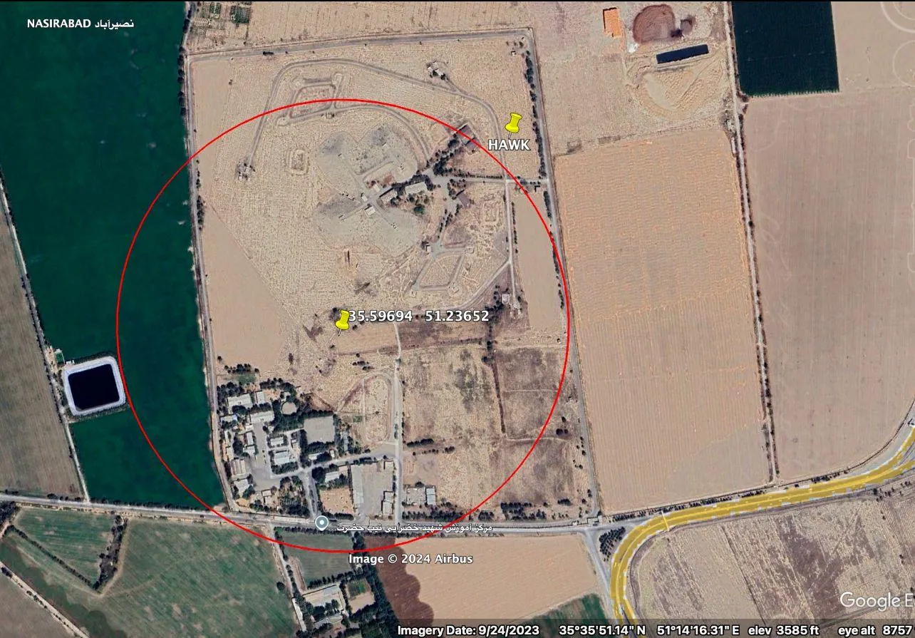
Confirming whether or not the activity actually was the result of an attack by the Israelis can be verified through the use of SAR data. Though much of Tehran was covered in clouds the following day, SAR is nonetheless able to produce valid analytical data. We used commercially available SAR imagery produced by the Copernicus satellite.
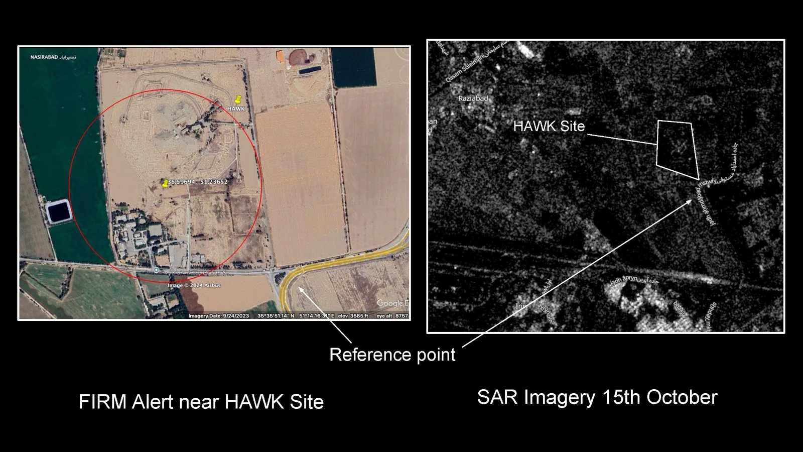
HAWK Site
The SAR image of the AD site on October 15th provides a reference point for the layout of the location. Of note are the spider-like grooves that make up the traditional layout of an AD site.
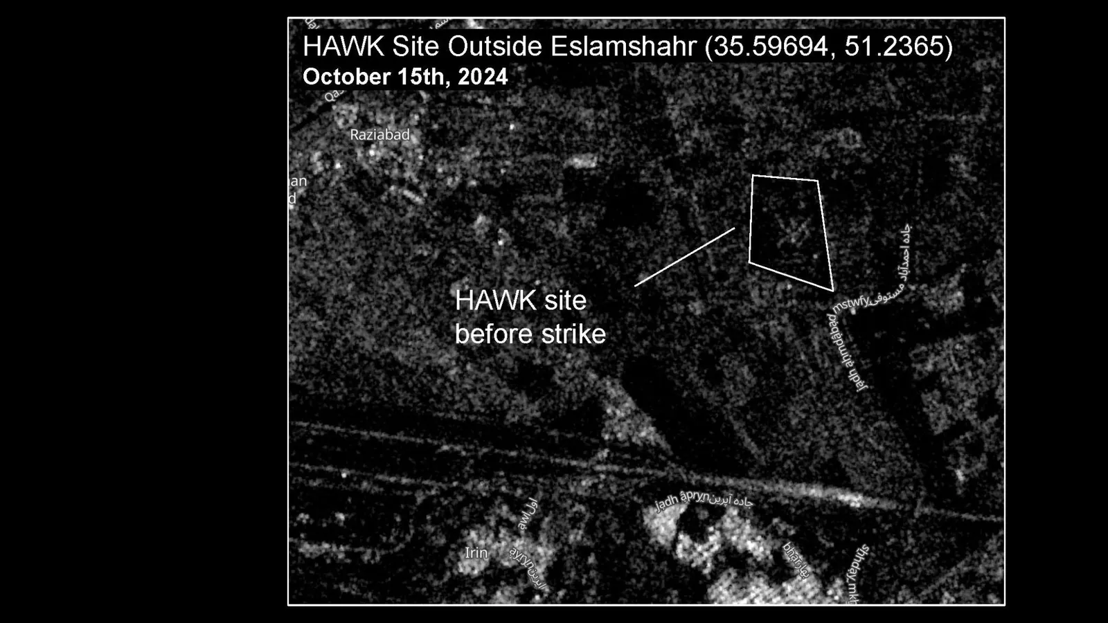
On October 26th, we observed clear differences in the terrain indicating that the FIRMS alert was indicative of unusual activity. Impact craters and restructured terrain are visible in SAR imagery from the 26th.
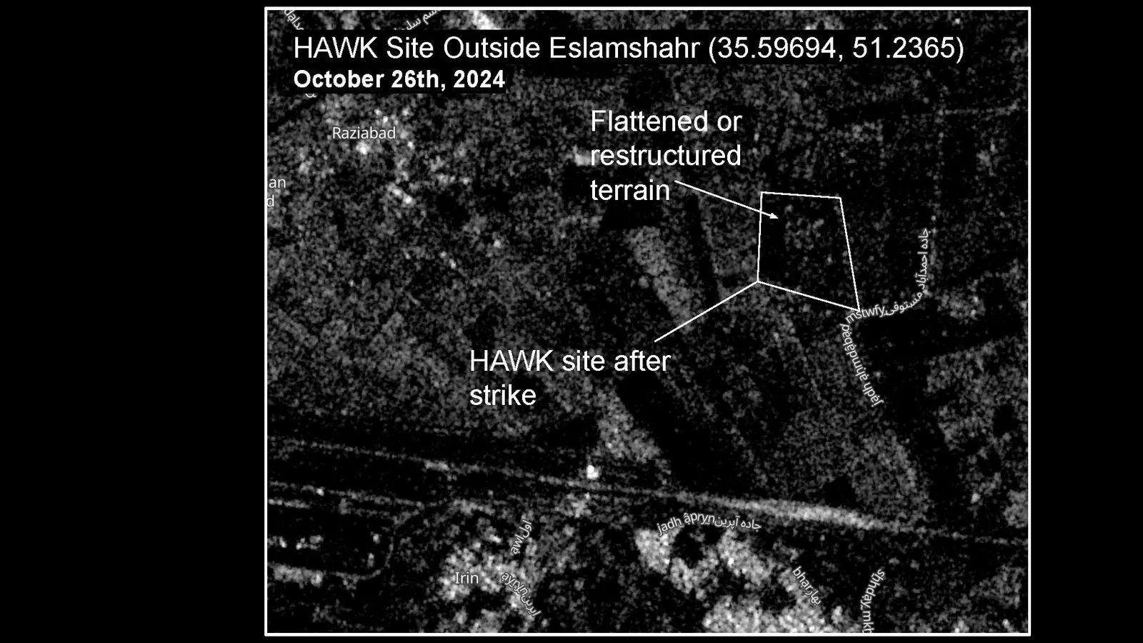
Strikes were later confirmed at the site through EO imagery by other analysts. However these relied on EO imagery which is subject to more control and can take longer to acquire during time-sensitive operations. The combination of FIRMS data with SAR imagery provides a faster, more acessible methodology.
Limitations
The use of this methodology is limited by the AOI created by FIRMS alerts and the inherent difficulty in interpreting SAR data. In high-density areas both the large AOI and the RNIIRS (usually about 3) of openly accessible SAR data impedes granular analysis. This form of analysis is best suited to sites that are not surrounded by urban structures. Furthermore, since FIRMS relies on infrared signals, it is bound to include a large number of false positives created by industrial facilities. Nonetheless, given the often rural nature of military sites and the open-access that this methodology affords, we believe it to offer an additional technique in the OSINT toolkit.